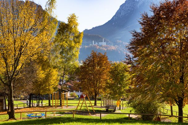
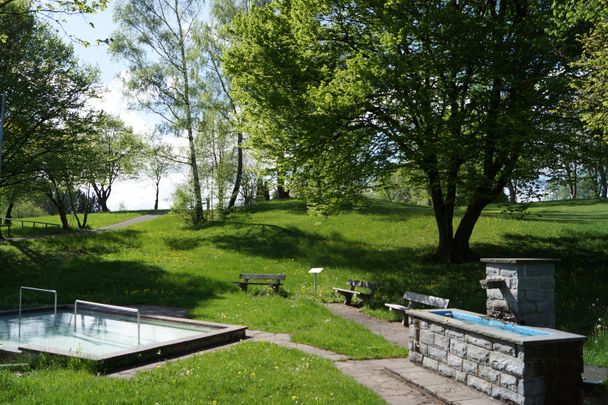
With its almost 5 km long network of paths, the Kurpark invites you to take relaxing walks. .
Tourist Information Schwangau
- Strecke6,55 km
- Dauer1:43 h
- Aufstieg26 Hm
- Abstieg21 Hm
- Schwierigkeit-
Höhenprofil
In 1824 the area was still used as a communal cattle pasture and only in 1936 it was redesigned as a recreation area for guests and locals. Today, the Kurpark is a certified terrain spa trail. Terrainkur trails are selected according to medical-therapeutic criteria (length, incline and decline) and classified according to difficulty. They must allow for a differentiated load capacity of the human organism.
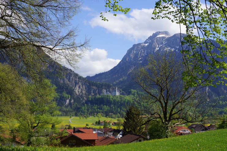
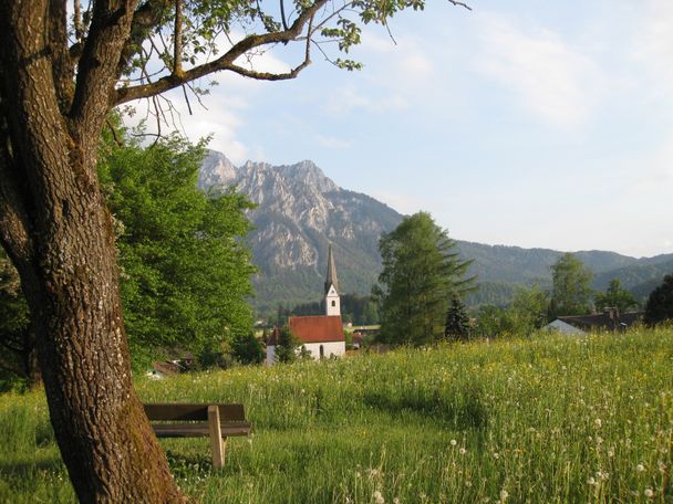
Depending on which point (e.g. town hall or the roayal crystal spa) you start from, simply follow the signs to Kurpark. Already on the way there you will find some beautiful viewpoints. Information boards inform you about the native trees, shrubs and birds. Stroll leisurely through the park, rest on one of the benches and listen to the chirping of the birds.
Anfahrt
In the direction of Schwangau centerParken
Parking possibilities:
- At the Schlossbrauhaus (walking time approx. 5 min through the middle village)
- At the Royal Crystal Spa (walking time approx. 2 min)
- On the parking lot of the municipality (on the Schlossstraße) - walking time approx. 5 min
Öffentliche Verkehrsmittel
Bus:
- Rathaus bus stop (walking time approx. 5 min)
- Föhrenbergweg (walking time approx. 7 min)
- Hotel König Ludwig (walking time approx. 7 min)

Tourist Information Schwangau
Tourist Information Schwangau
Tourist Information Schwangau
Tourist Information Schwangau
Tourist Information Schwangau
Ähnliche Touren
- Wandertour
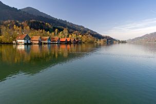
Rundweg - Schwangauer Ortseile am Forggensee
© Tourist Information Schwangau
Flacher Wanderweg entlang des türkisen Forggensees mit wunderschönen Ausblicken auf die Schwangauer Berge und die Königsschlösser. Vom Ortsteil Brunnen führt die Rundtour über Waltenhofen nach Schwangau und anschließend wieder nach Brunnen.
mehr dazuDistanz 4,3 km Dauer 1:00 h Aufstieg 7 m Schwierigkeit leicht - Wandertour
Allgäuer Wandertag - Etappe Nesselwang Oy-Mittelberg
© Gemeinde Nesselwang
Sonntag, 05.05.2024 ab 9 Uhr
Aussichtsreiche Wanderetappe zum Allgäuer Wandertag.
mehr dazuDistanz 11,0 km Dauer 3:20 h Aufstieg 348 m Schwierigkeit - - Wandertour
Etappe 8 - Lech - Formarinsee
© Lech Zürs Tourismus GmbH
Von Lech vorbei an Zürs bis zum Formarinsee
mehr dazuDistanz 14,6 km Dauer 4:40 h Aufstieg 493 m Schwierigkeit mittel - Wandertour
Lechweg Etappe 6 - Steeg bis Warth
© Werbegemeinschaft Lech-Wege
Von Steeg über Lechleiten und Gehren bis nach Warth.
mehr dazuDistanz 15,4 km Dauer 4:20 h Aufstieg 206 m Schwierigkeit mittel - Wandertour
Premiumwanderweg Grenzenloser Weitblick
© Oberstaufen Tourismus Marketing GmbH
Eine Tour der Nachbargemeinde Riefensberg (A) auf den dortigen Hausberg mit viel Natur und schönen Ausblicken. Das Highlight der Runde ist der gesicherte Steig durch das Kojenloch. Einkehrmöglichkeiten sind vorhanden.
mehr dazuDistanz 11,8 km Dauer 5:00 h Aufstieg 666 m Schwierigkeit mittel - Wandertour
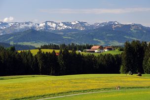
Alpsee Rundweg
© Tourenportal Oberallgäu
Der Große Alpsee ist ein malerischer Natursee umgeben von saftig grünen Wäldern und Wiesen. Er ist ein beliebtes Ziel für Erholung und Outdooraktivitäten.
mehr dazuDistanz 11,0 km Dauer 3:05 h Aufstieg 167 m Schwierigkeit leicht - Wandertour
Kneippwanderweg Teil 1: Bieslings bis Buflingsried - Christians Wandertipp
© Landkreis Lindau (Bodensee)
2021 wird der 200. Geburtstag von Pfarrer Sebastian Kneipp gefeiert. Anlässlich dieses Jubiläums führt Sie Christians Wandertipp auf dem ersten Teil des Kneipprundwanderwegs von Bieslings nach Buflingsried.
mehr dazuDistanz 6,4 km Dauer 1:47 h Aufstieg 115 m Schwierigkeit leicht - Wandertour
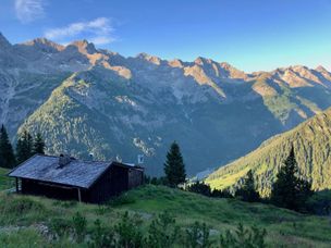
Von Hinterhornbach aus auf den Hochvogel
© Gästeinformation Bad Hindelang
Anspruchsvolle Tagestour vom Bergdorf Hinterhornbach hinauf zum Hochvogel.
mehr dazuDistanz 7,6 km Dauer 3:53 h Aufstieg 1.649 m Schwierigkeit - - Wandertour
Von Immenstadt nach Bühl - Achis Wasserweg
Dieser spannende Themenweg entlang der Konstanzer Ach in Immenstadt dreht sich rund um den Lebensraum Wasser sowie unser wertvolles Grund- und Trinkwasser. Eine Tour für die ganze Familie!
mehr dazuDistanz 2,3 km Dauer 0:35 h Aufstieg 3 m Schwierigkeit leicht - Wandertour
Wertachrunde in Thalhofen
entspannende Wanderung entlang der Wertach
mehr dazuDistanz 2,9 km Dauer 1:00 h Aufstieg 10 m Schwierigkeit leicht


Die Inhalte dieser Seite werden in Kooperation mit Outdooractive bereitgestellt.